LIDAR PHOTOGRAPHY SEES ANCIENT GUATEMALA BENEATH THE JUNGLE

Fig. 1- Illustration of Mesoamerica highlighting important sites of cultural and historical significance Google Earth Map

by Cheryl Norman (The legacy of V. Garth Norman lives on)

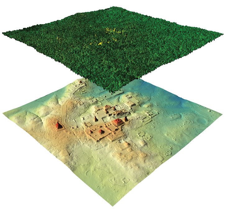
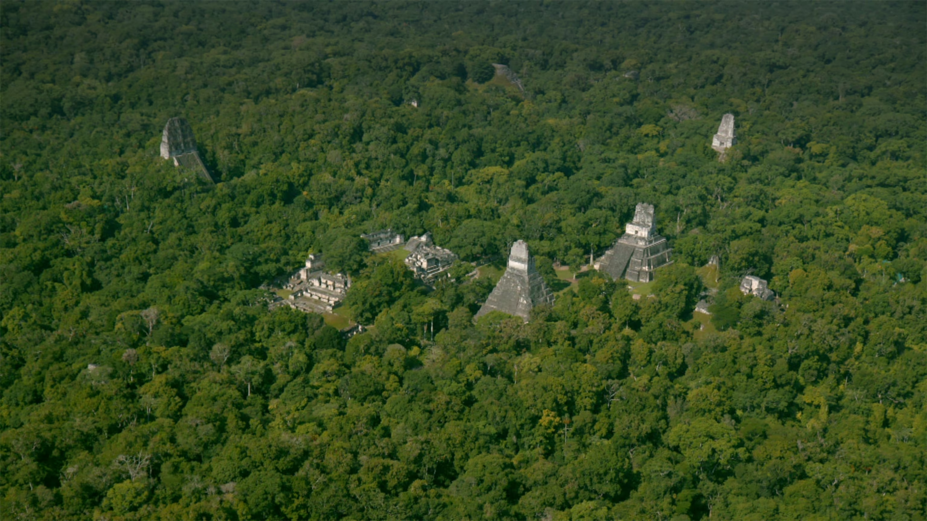
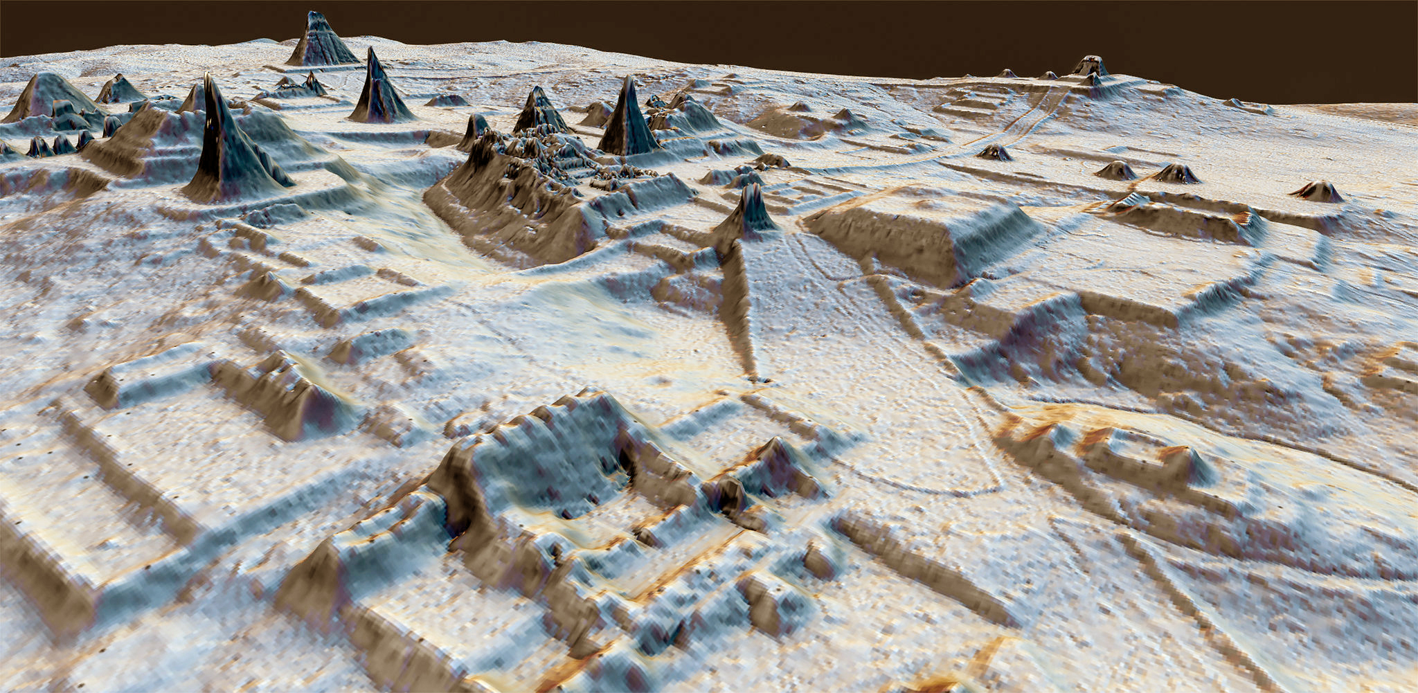
National Geographic 2018: LIDAR airplane photography revealed 60,000 structures near Tikal, Guatemala that would possibly have been inhabited by millions of people. These structures include roads,

pyramids, corrals, agriculture, and fortifications. Watch these videos to see the results of airplanes flying over dense jungles with special photography equipment that shows what is beneath the dense forest of trees.

Fig. 2- LIDAR scanning is able to detect details below the dense canopy National Geographic photo
Fig. 3 - Guatemalan landscape hidden under dense forest canopy National Geographic photo
Fig. 4 - Ancient High Mesoamerica Civilization seen by LIDAR photos beneath dense jungle.

Watch these video to learn more about Lidar Photography

Dr. Richard Hansen