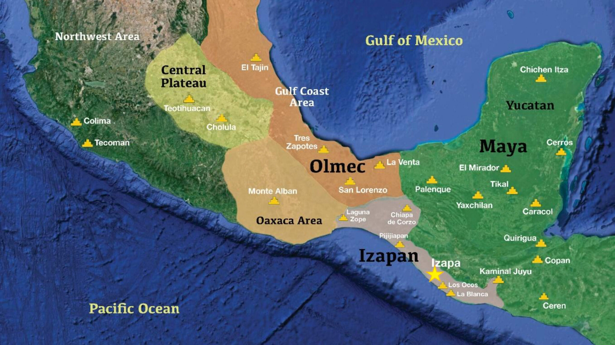
Olmec settlers migrated from LaVenta on the Gulf of Mexico in about 1500 BC south to the 14.8° North Latitude to establish the sacred 260-Day “Gestation” Calendar at Izapa, Mexico. These Olmec (Jaredite) people had observed that most animals mate in the Fall and have their babies in the Spring when the rains come from the heavens and vegetation grows from May to October of each year. This vegetation is food for the animals and NOW for human beings to survive.
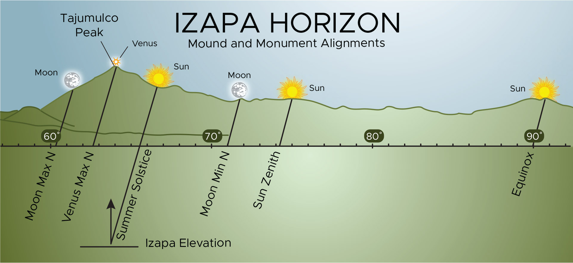
At Izapa, Mexico the Sun Zenith Passages are on August 13 & April 30 = 260 days between these 2 passages. If humans mate near August 13, their babies will be born near April 30 when the Spring rains cause food to grow for their Mothers and babies to survive.
These ancient people had many treasured children. These Olmec people built Plaza B at this new Izapa, Mexico Temple Observatory that was oriented to the eastern Mount Tajumulco. They used the Middle Eastern Babylonian and Egyptian cubits to build pyramids and carve scenes on stone monuments called “stelae”. Their Plaza B is near the eastern river. They eventually built a large, stepped pyramid.New Maya (Nephite) arrivals landed on the Pacific Coast (ca. 590 BC) and made their way first to “Kaminaljuyu, Guatemala” which is today’s Guatemala City. From there, they migrated to the Izapa Temple Observatory at the decline of the Olmec (Jaredite) civilization around 550 BC.
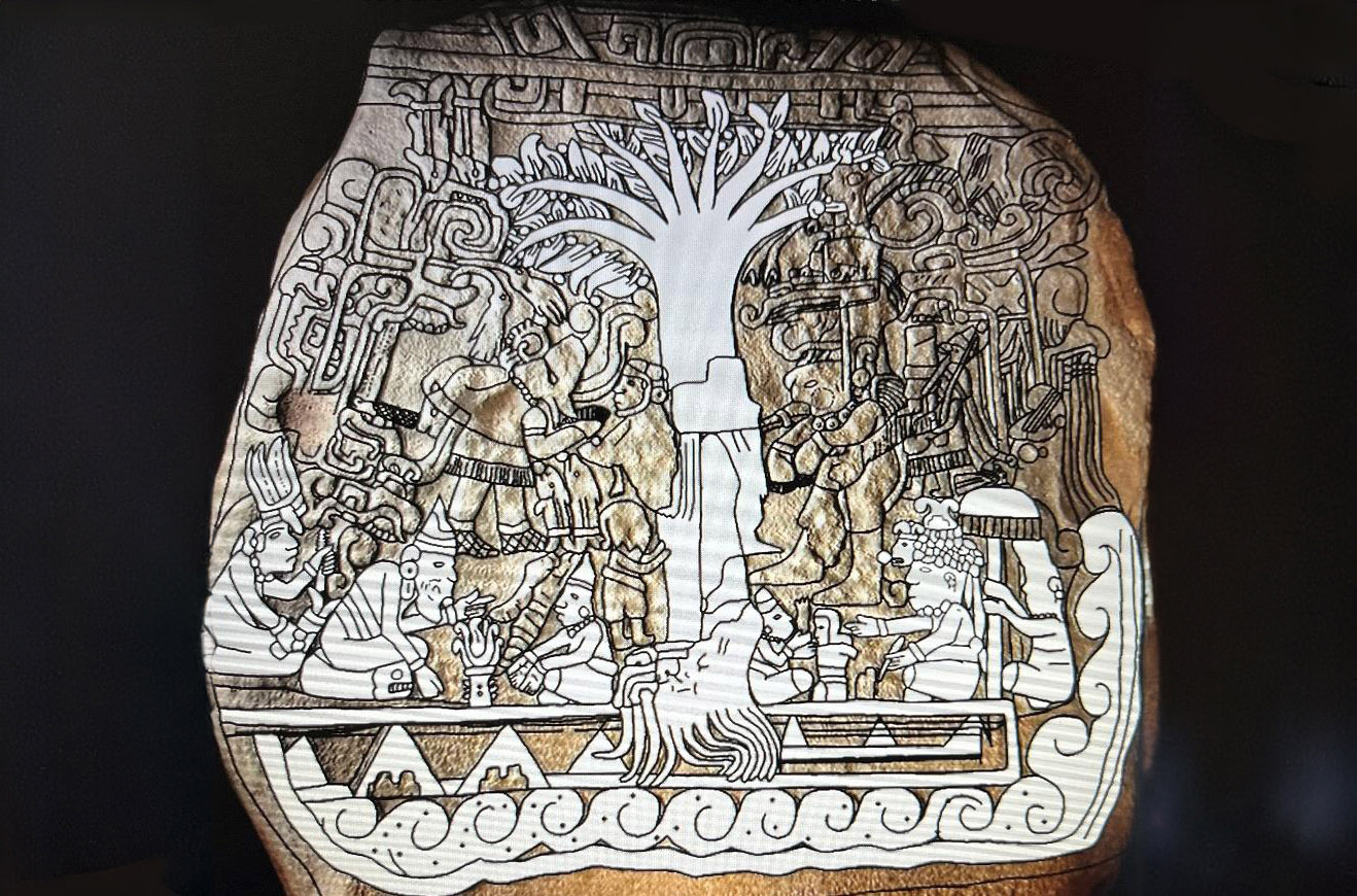
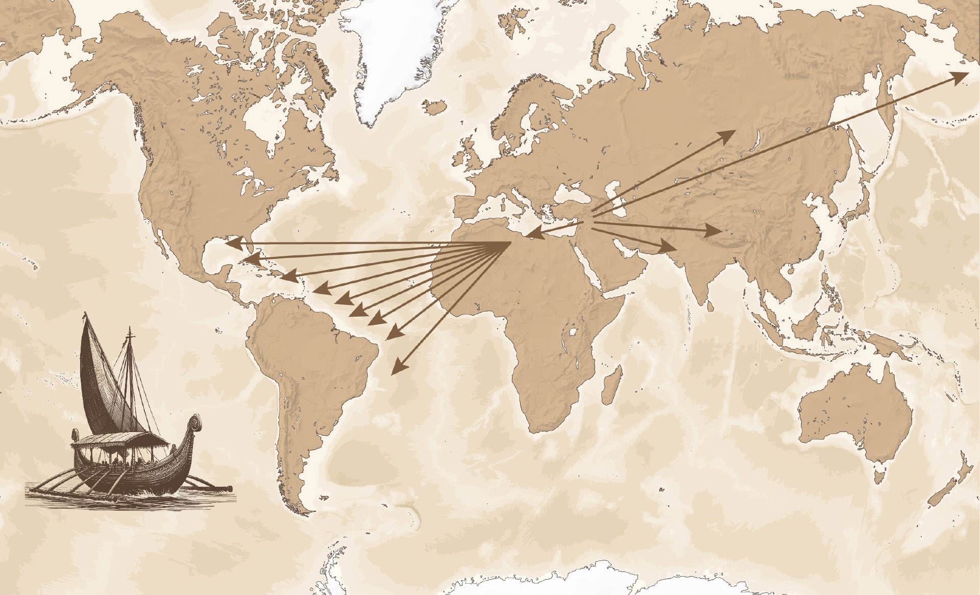
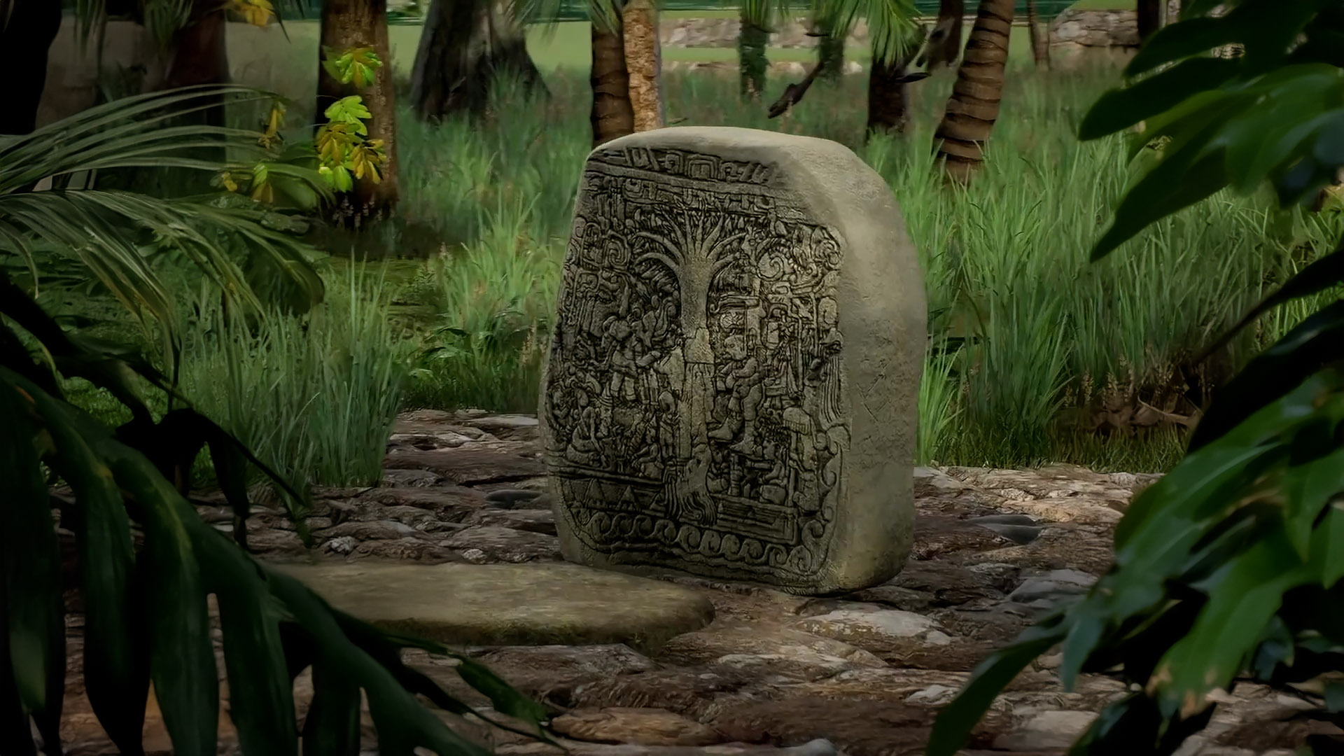
These new bearded foreigners built additional Plazas, and carved many picturesque stelae using the Babylonian and Egyptian cubits, just as the Olmec did. Most of their pyramids, and stone monuments aligned toward sun, moon, star, & Venus rises on the eastern Mount Tajumulco. (Fig. 3). Their most famous monument is Stela 5, the “Tree of Life” carving (Fig. 2). A map like the one at the top of this article is displayed in the cultural center of the Maya city of Momostenango, Guatemala. The Maya today maintain that their ancestors migrated from across the sea from where the sun rises, and landed on “an isle of the sea” (2 Nephi 10:20): “The Lord has made the sea our path, and we are upon an isle of the sea.” This “isle” correlates well with Mesoamerica, which is almost surrounded by water. There is much evidence of these ancient migrations to Mesoamerica, specifically in Guatemala, where the K’iché kingdom was, and where their sacred book, the Popul Vuh was being written for hundreds of years.
In 1941, a Smithsonian/National Geographic crew made their way to Izapa. Their findings stimulated the BYU New World Archaeological Foundation to begin excavating, exploring, researching, and publishing their findings about the Izapa, Mexico Temple Observatory. Archaeologist V. Garth Norman was hired by NWAF in 1962 to 1980, publishing three works in 1973, 1976, and 1980. He continued his research for the next 40 years, publishing three more major works on Izapa.